


Voting District 40915, Kern County, California
About
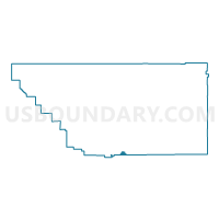
Outline

Summary
| Unique Area Identifier | 531289 |
| Name | Voting District 40915 |
| County | Kern County |
| State | California |
| Area (square miles) | 5.96 |
| Land Area (square miles) | 5.93 |
| Water Area (square miles) | 0.03 |
| % of Land Area | 99.46 |
| % of Water Area | 0.54 |
| Latitude of the Internal Point | 34.82805430 |
| Longtitude of the Internal Point | -118.72972610 |
Maps


Graphs
Select a template below for downloading or customizing gragh for Voting District 40915, Kern County, California


Neighbors
Neighoring Voting District (by Name) Neighboring Voting District on the Map
- Voting District 20060, Kern County, CA
- Voting District 20370, Kern County, CA
- Voting District 40920, Kern County, CA
- Voting District 54845, Los Angeles County, CA
- Voting District 54851, Los Angeles County, CA
Top 10 Neighboring County Subdivision (by Population) Neighboring County Subdivision on the Map
Top 10 Neighboring Elementary School District (by Population) Neighboring Elementary School District on the Map
- Westside Union Elementary School District, CA (69,586)
- Arvin Union Elementary School District, CA (19,762)
- Gorman Elementary School District, CA (172)
Top 10 Neighboring Secondary School District (by Population) Neighboring Secondary School District on the Map
- Kern Union High School District, CA (596,351)
- Antelope Valley Union High School District, CA (373,523)